
We’ve all seen on the news the damage that floods can cause and maybe some of you have even had a personal experience. I have always felt sorry for those who have lost everything especially if it was a one-time occurrence. What I couldn’t grasp however was why people who lived in areas that flooded multiple times just didn’t move. But as an owner of AAA Alaskan Outfitters I experienced numerous floods and didn’t want to move or maybe business wise couldn’t move. At that point you just have to deal with it. So now I guess I understand why they just didn’t move. These are AAA’s flood stories.

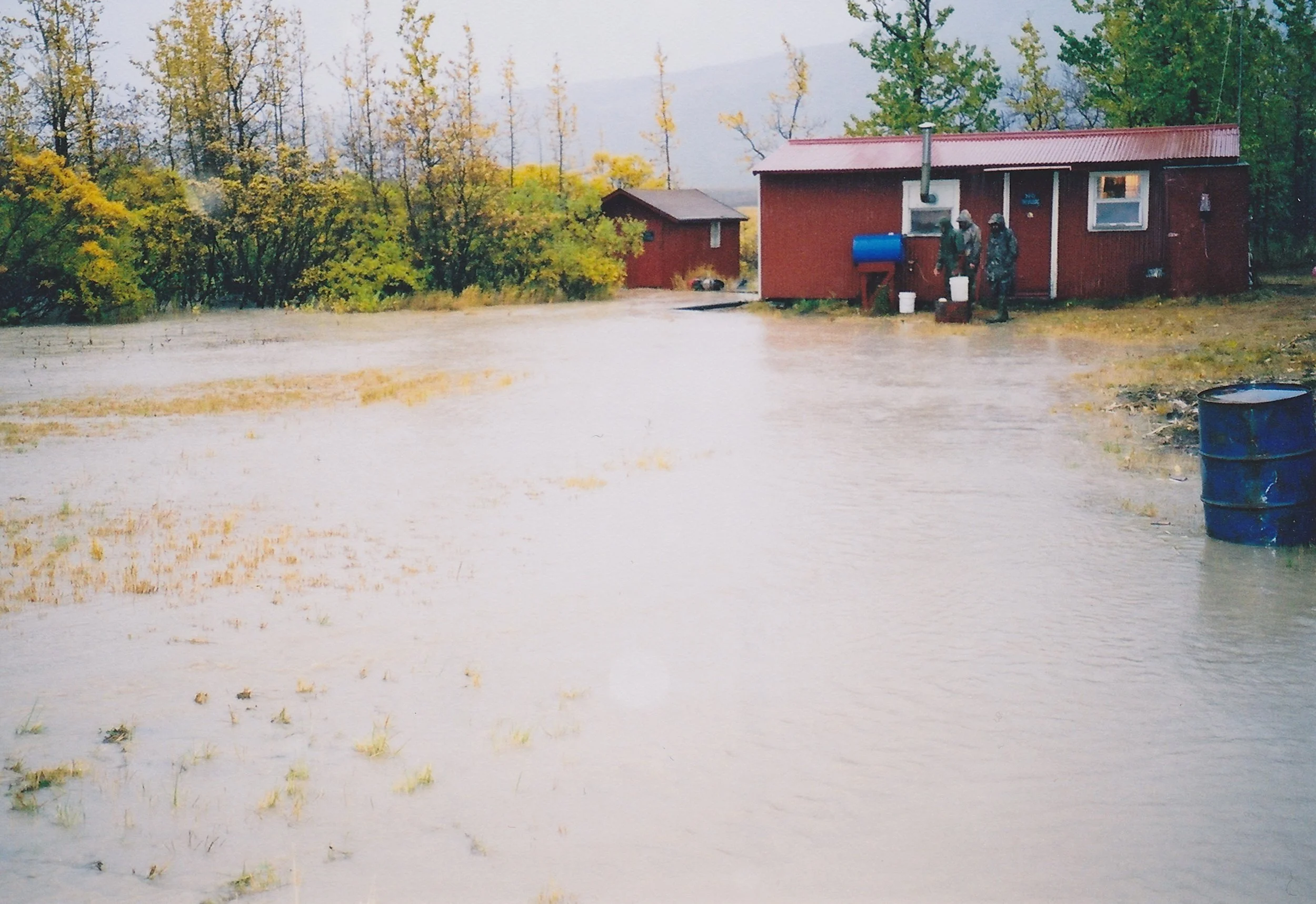
The Dog Salmon River camp during an October flood.
It was sheep season August, 1985; I was lying on my go-cot in a state of frustration wondering when the rain was going to end. Tom Heller, my sheep hunting client from Texas, and I had been confined to the tent for over 48 hours only going out when nature called. All of sudden, my hand dropped to the floor of the tent, and I yelled, “Water.” We had about a half-inch of water that had come up from the ground underneath us. The ground had reached its saturation point. We grabbed our rain coats and headed outside. The runway and most everything else around us had a couple inches of water. I found one fairly flat place about fifteen yards to our right that was about a foot higher in elevation where I could move the tent. We just picked up the tent and moved it over. I dug a trench around the three higher sides. Over the next four or five hours we watched big sections of the hillside across the creek just slough off and form new creeks. That kind of rain was normal on the Alaska Peninsula but not in the Wrangell’s and especially in August. The small creek beside us which was usually one to two feet deep had risen approximately six to eight feet. Canyon Creek itself was now a raging river about two hundred yards wide. We weren’t in any danger because the little creek needed to come up another ten feet and Canyon Creek was at least 50 feet below us so we were fine but I just wanted it to stop. It was time to hunt!

Canyon Creek during our 52 hour rain storm.
Brent and Dan and their two clients along with George Lockwood our wrangler had taken the horses into Erickson Creek. Brent said they had their tents set up along the side of the creek and after a couple of days of hard rain the creek had started rising so they moved their tents up about five foot higher into the brush. Within thirty minutes the creek filled up and became a raging river with large trees floating by right where their tents had been.

Erickson Creek right after Brent and Dan moved their tents.
In my twenty years of hunting in the Alaska mountains I had never experienced anything like it. It was the first time that we had used this strip. We ended up calling it the “swamp camp strip.” The funny thing is, after hunting the area for twenty more years the strip never got any water on it nor did the original spot where we set the tent up. It was a weird storm for sure. I wish I could say those were our worst water problems but unfortunately that was only the beginning.

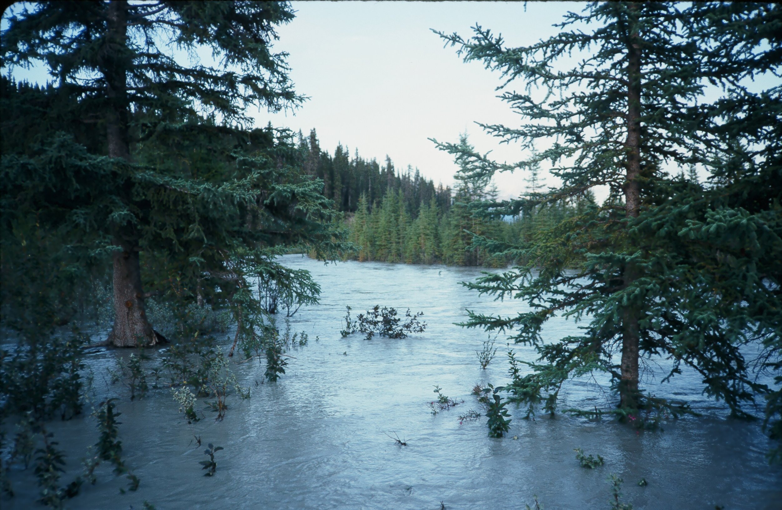
The Dog Salmon River camp in the summer of 1989. This photo shows the small channel between the cabin and the runway.
In 1987 AAA Alaskan Outfitters purchased the Dog Salmon River camp. The beauty of the setting was only second to our Big Bend Lakes camp. It had cabins by a clear water creek with salmon and trout fishing at your door step. It was surrounded by beautiful mountains with a 1000 foot air strip that could be used by flying services to bring in our clients. What else could we ask for? Life at the Dog Salmon was good.
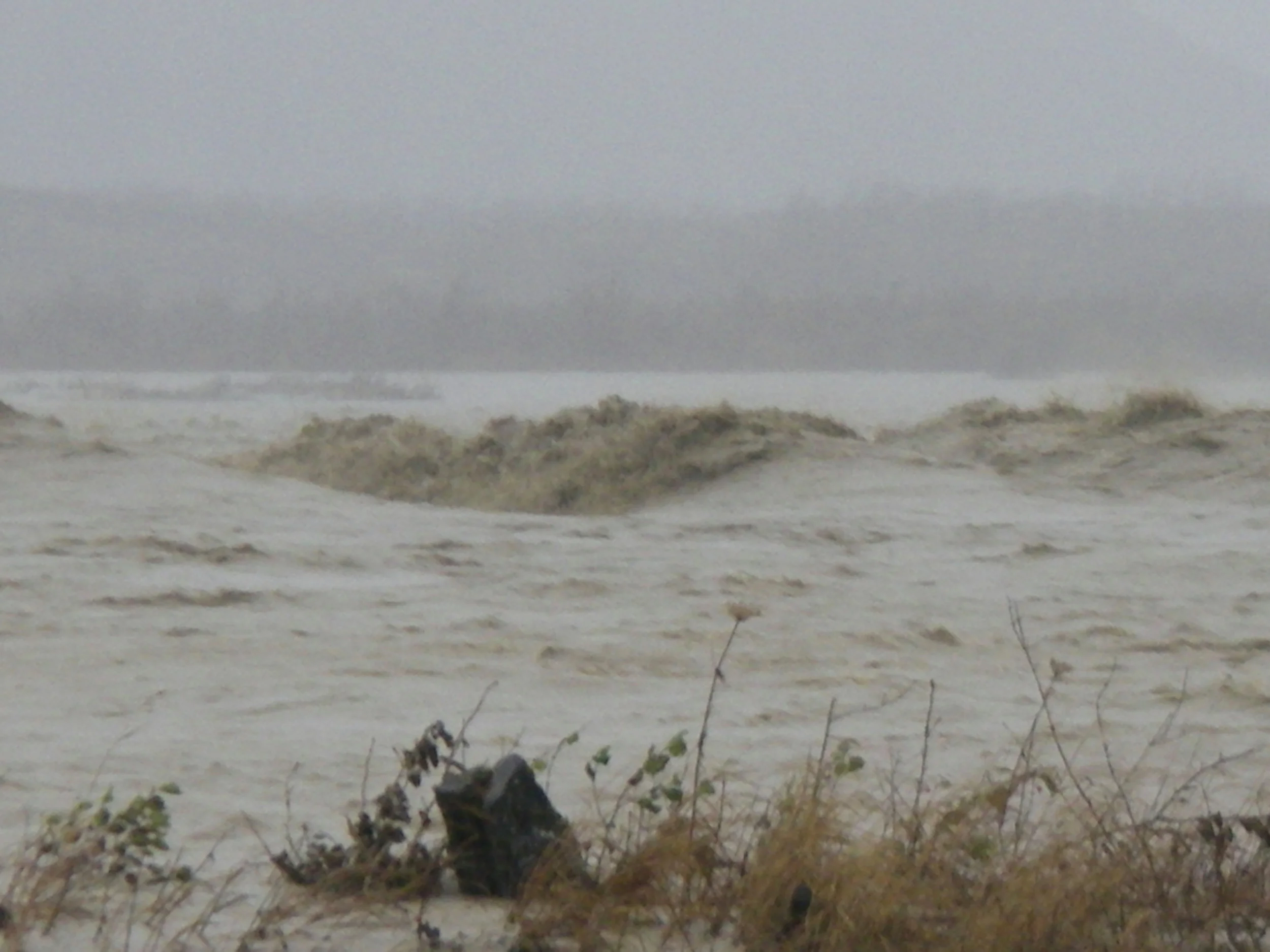
Then in ’89, our first fall season, the waters came. The high water only lasted three or four days and it left us a nice surprise. It filled in the small channel that was between the cabins and the airstrip. For a year or so we could taxi the cubs into the yard for loading and to tie them down. The next flood however took out a couple hundred feet of the main strip. So we now had a 700 to 800 foot strip into the wind. After a couple of years, the river cut the small channel back between the strip and the cabins so no more taxiing into the yard.
The camp during one of the floods.
Most of those changes occurred during the fall storms in September and October. Both Dan and I were guiding at Otter Lake in September and Cold Bay in October so that left Brent by himself to deal with the floods and to come up with new plans. The first thing he did was improve a small emergency strip that Ken Oldham had cut by the cabin. Every year he made it a little longer using nothing but intensive manual labor. Eventually we lost the entire strip on the river but by that time Brent had a 900’ runway running toward the cabins. That was as long as he could make it because of a small creek that cut across the valley. But that was enough and it was mainly running up and down the valley so the winds were good most of the time.

Pete Clark, one of Brent's hunters with a salmon he caught during normal water levels.
This is where Pete, from the last photo, was fishing. Mighty big rollers!!
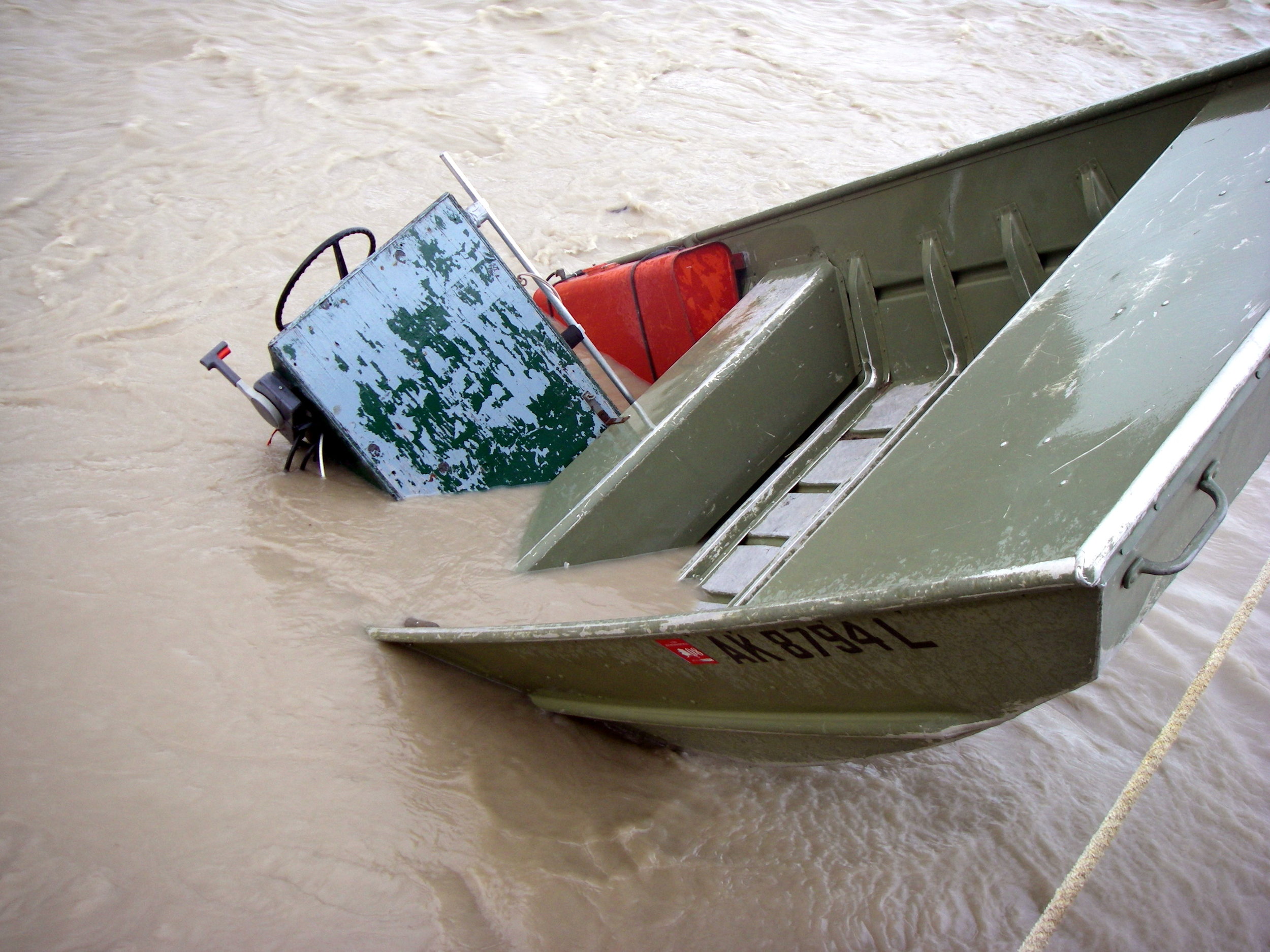
AAA's boat close to where Pete was standing.
Every year that we had the floods, water would get around the cabins but the thing that saved them was a 100 foot high ridge that blocked the river from hitting them directly. Brent tried using 55 gallon drums filled with rocks at the end of the ridge to push the river farther away from the cabins. The first time it just knocked them over. He did it again making three sets and used big rocks behind the last set and bolted that set together. That was the only set that stayed. It might have helped a little but every year the river still tried to change its direction.
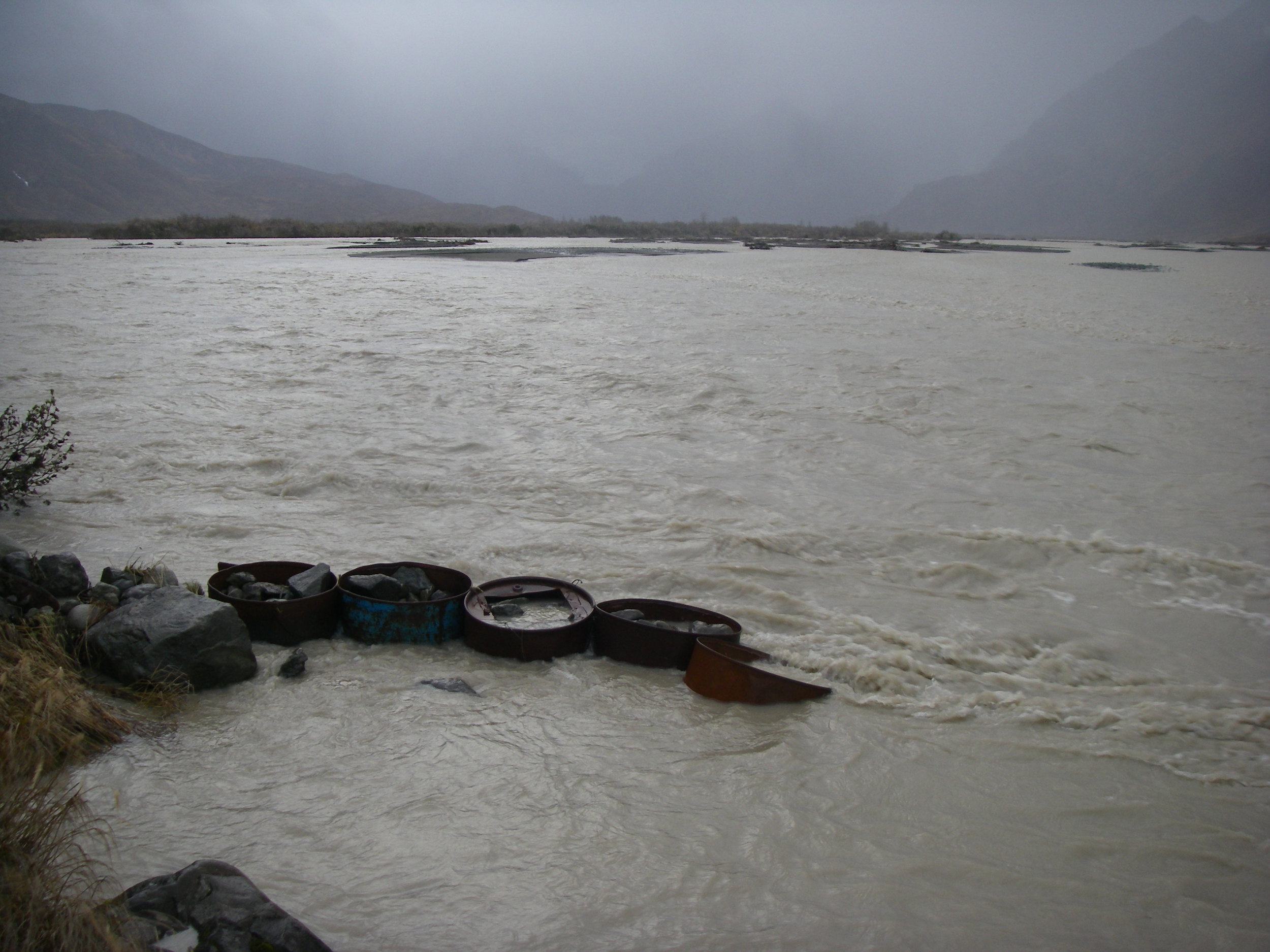
The last set of 55 gal drums that Brent filled.
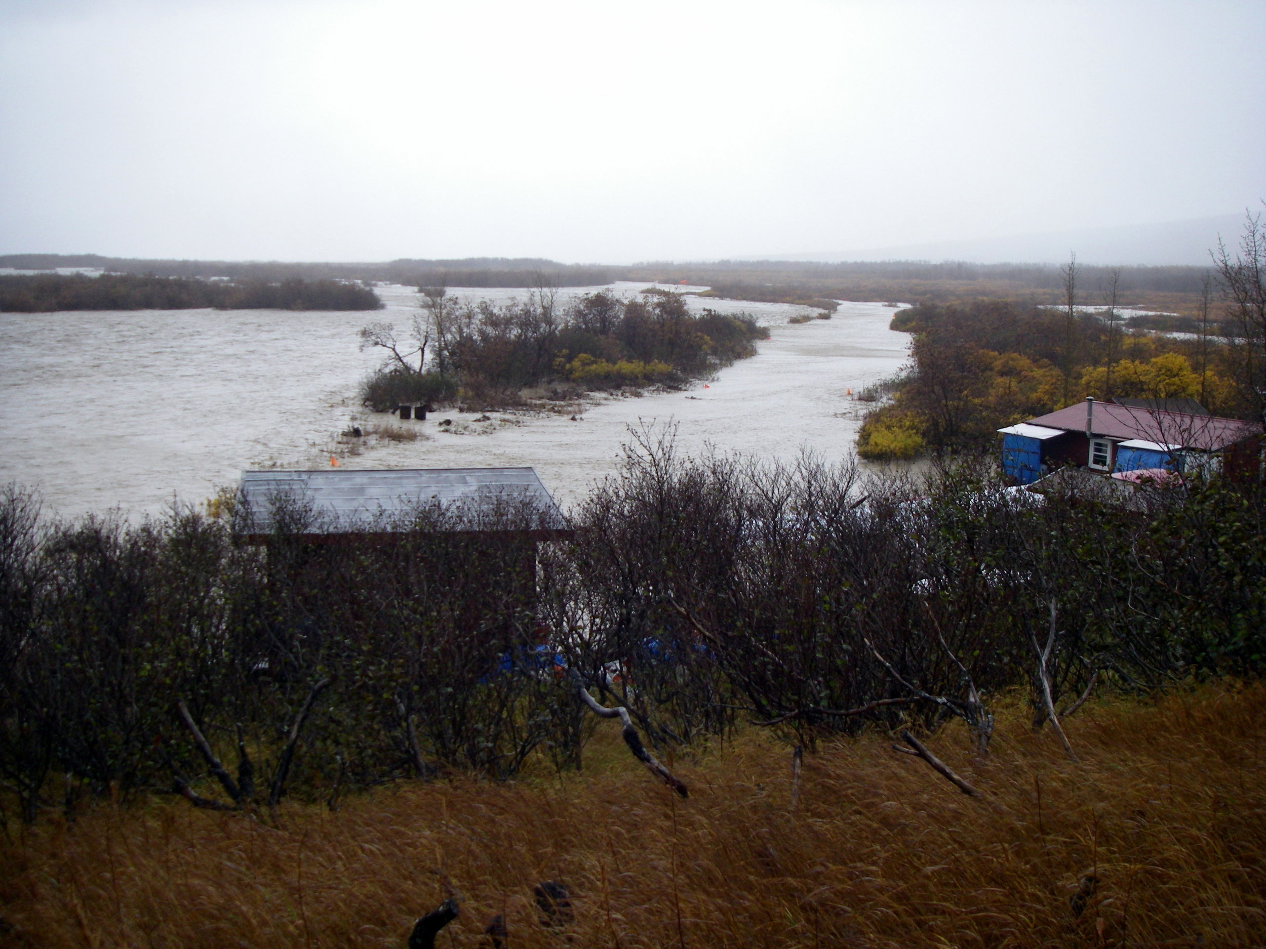
Photo taken from the ridge that blocked the river from hitting the cabins. You are looking down the runway.

Looking down the runway during another flood. 1936A, on the left is the super cub that I flew. .

Almost time to fly. The water goes down fast after the rains stop.
In 1993, the Alaska Department of Fish and Game closed the caribou season around the Cold Bay area so AAA shut down its fall bear season. Because of that closure Dan and I were at the Dog Salmon River camp for the next six fall brown bear seasons allowing us to experience the floods first-hand. I think we had at least three or four before I retired in 2005. During a couple of those floods we had a foot of water around the super cubs that were tied down on the strip. We really never knew just how much water we were going to get. The fall storms usually lasted four or five days and then occasionally they came back to back. Being on the Alaska Peninsula in the fall can be miserable.
Brent and I leaving Bryson Bar in 1984 after our first season in the Wrangell's.
1936A setting on the beautiful dry strip at Bryson Bar.
Bryson Bar, our main camp in the Wrangell’s, was located in the Chitina River Valley. It had a crystal clear stream running right by it and an 800’ runway in the trees. A perfect setting for a cabin. The valley floor was between 3 and 4 miles wide where the cabin was located. When we purchased it in 1984 the Chitina River was on the opposite side of the valley and was fed by hundreds of glaciers. The big ones being the Chitina, Logan, Bernard and Walsh Glaciers. Because of all the sediment in the feeding waters the river changes it channels continuously but slowly. The high water time in the Chitina River valley was mid-July to mid -August because of the hot weather melting the glaciers. I guess I really didn’t know just how much glacier fed rivers really move. I remember one day cleaning up trash that some old hunters had left next to the hillside by the cabin and Dan saying, “You can tell that the river was on our side of the valley many years ago” and I said, “Yep, maybe” but really didn’t think too much about it.
Several years later our clear water stream picked up some glacier color during a hot weather week in August. Then in 1992 while Dan and I were guiding our first sheep clients high in the mountains, the little clear water stream with the help of the glacier water came over its banks and flooded the corral but was back down before we got back to Bryson.

Dee, Dan and me carrying gear from the cabin to a place we could land, about a mile away.
Our clear water stream over its banks.
Then in ’93 it happened! The Chitina River came for a visit, a big visit and never left. I was unable to land at the runway that year. Thanks to our neighbors Paul and Donna Claus, we were able to set up a big weather port tent for our base camp at the end of their runway. That worked great for a couple of years until the Chitina River moved all the way over and started taking their runway. It was hitting the five foot river bank and taking two or three feet of the runway daily. During that time Paul and Donna were building a new runway about fifty feet higher on the mountain and then moved their new lodge and other buildings up above the new runway. That was quite a feat but they did it. That is where it sets today overlooking the river. It is a beautiful lodge. We had to move to the opposite end of the runway and when we left the Wrangell’s in 2004 there was only five hundred foot of a thousand foot runway left. I never got to land again at Bryson Bar. The main river took over and at one time the high water mark on the cabin was about three foot up on the cabin. I will have to say that we made it sturdy because it never came off it posts even with the main force of the river hitting it. It took out all of the trees that I’m sure were at least fifty years old.

A few years later after the water had receded. The main channel is to the right.

Bryson Bar- You can see the old water line on the side of the cabin. This is one of the main channels of the Chitina River now.
It was a sad time but you do what you have to do. Having a guide operation is a lot work and in the wilderness you are always being thrown curve balls so you are constantly changing your plans. I guess that’s life!